[In her own words]
So I've now made it through the Shenandoahs. Everyone said the Shennies were easy and flat. Well, the trail was well-graded (few rocks or roots, nice gravel surface), but it wasn't flat. Relative to most of the rest of the trail, yes, but not flat. There were also not very many views. When the trail crossed the Skyline Drive (28 times in total) near an overlook you got a view. But I was hiking with some fun guys--Mellow Yellow and Sockburn. Also known as the Shenandoah National Petting Zoo, I saw a lot of deer who were not timid of people. Lots of squirrels. And 3 bears...cubs. They were up a tree and ran down and away as I approached. My attempts at "yogi-ing" (getting free food from non-hikers by looking hungry) failed. Partly because some of the campgrounds weren't open yet, but mostly because not many people were around. I did stop at one of the many trail-side Waysides (rest stops/cafe/gift store) and had a blackberry milkshake. It was excellent but severely overpriced.
May 10. A Trail Magical Day. I walked into Linden, VA to pick up my mail drop, and I had 5 packages!! The expression on the postal clerk's face as he handed them to me was priceless. I ate a lot of it on the spot, and shoved the rest in my pack for eating on the trail. Thanks everyone! Right before heading into town, there were a bunch of sodas and beers in the stream, but being 8am I decided to leave them for later hikers. I stopped at Manassas Gap shelter for lunch, where a group of Japanese day hikers were having a feast (including fish, seaweed wraps, etc.) and they gave me a short rib. I found a book at the next shelter (I had finished mine last night). Then there were oranges and root beer along the trail in the afternoon. Crazy amount of trail magic for one day.
May 11. 50 degrees and rain and gusty wind. I hiked across the Roller Coaster section (13.5 miles of steep ascents and descents) with tree branches blowing down all around me. The trail corridor is really narrow (hemmed in by private land), so the trail builders had little choice on where to put the trail). It was a harder section, but not too bad overall. I think the hardest part was crossing the 4 lanes of VA 7...in the pouring rain. I stayed at the Blackburn Trail Center (run by the Potomac AT Club), where they have a free hostel with wood stove (Heat!!), and the caretaker fed us spaghetti, home made bread, chocolate cake, and ice cream. It was a good night, even though I slept on the porch because it got way too hot inside.
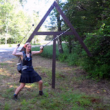
May 12. Harpers Ferry. The psychological half way point of the trail. The first NOBO to come through this year was Nature Boy (remember him? he got stuck in the snow in VA, and was day hiking in GA when I started) on April 4. I am #55, and the 7th female (3rd hiking solo) to arrive. I toured the historic section of town this afternoon, had a huge cookies and cream milk shake, and am heading to my cousin Sarah's place in Baltimore tonight. I'm looking forward to a shower and laundry!! 1014 miles down, 1165 to go!
Showing posts with label VA. Show all posts
Showing posts with label VA. Show all posts
Wednesday, May 12, 2010


Tuesday, April 27, 2010
New Trail Notes and Pictures
Today (Tuesday April 27th) Emily is in Bedford, VA at her Uncle’s house. She's taking a zero day, as in hiking zero miles, to recharge and upload photos. For the next few days she'll be doing some slack packing, which means to day hike and use the same sleeping location every night. In this case the sleeping location is a real house!
While not really a journal entry, Emily had this to say:
Keep thinking of superlatives and random facts you'd like to hear about. Right now the list is less than ten items, we can do better than that!
While not really a journal entry, Emily had this to say:
While walking all day (often by myself), I have re-written a couple songs. “Ode to Maintainers” (to The Man on the Flying Trapeze): “You maintain the trail with the greatest of ease; cut blowdowns in pieces move branches and trees; though just volunteers you’re as busy as bees; three cheers for the trails maintainers…ees; (where are you please??)”. For those of you familiar with Michael Cooney’s song about Bosco: “I hate blowdowns, they’re bad for you and me. When you try to walk them they’ll scrape up both your knees. Push through slowly or end up your belly, and then you’ll hate the blowdowns—just you wait and see!” The good news is the maintainers have been out now on most sections, so you can once again hike (rather than clamber) along the trail.
Keep thinking of superlatives and random facts you'd like to hear about. Right now the list is less than ten items, we can do better than that!
So after Damascus:
MAN was my pack heavy on that uphill climb out of town (yes, it is always uphill after town stops). I’ve definitely gained a hiker appetite…so trying to carry 8 days of supplies was a challenge (but still possible). I did my first 20 mile day on the 14th, and have done several since. I climbed Mt. Rogers, the highest mtn in VA. No views, but the summit is covered with Fraser firs, so I felt like I was on a real mountain. Most mountains/ridges down here have large deciduous trees so it feels like low elevation to me, and all the rhododendrons make me feel like I’m walking thru someone’s tropical shrubbery garden. The VA highlands and Grayson Highlands were beautiful. Grassy ridges (lots of views), rocky trail…and wild ponies. They are eager to be scratched, and love to lick the salt off sweaty hikers and their gear.
April 15
500 miles hiked so far. The night before Frost, Picker and I had a celebratory campfire. The trail so far in Virginia has been a lot of ridge walks, and then it dips into valleys and crosses cow pasture. I’ve climbed over a lot of stiles (wooden ladders over fences), and even had to shoo cows off the trail. Definitely a difference feel than the Maine AT.
April 17
Met some maintainers (Piedmont ATClub) building rock steps—they asked if I wanted to help them collect rocks, and then suggested I take some back to Maine (or at least take a Pulaski back). I declined. I also had to convince them I was from Maine, since I don’t really have much of a Maine accent. The next day two guys (Pine and Dreamcatcher) tried a 50 mile day. Turns out they only did 47 b/c of bad signage, and they were sore for a couple days after…but they said they’d do another 50 again. Crazy. I like 20 mile days just fine.
April 21
Ducked into Pearisburg to resupply, but decided not to spend the night (false rumor that the hostel was closed) so I camped a couple miles out of town. Met up with a new group of hikers: Mellow Yellow, Cookie Monster, Sockburn (from Germany, he burns his worn out socks), Hobbot. The birds are singing around 6:15 in the morning, so I’m getting early starts. Lots of birds out, lots of flowers (trees and shrubs too), and high humidity. Dragons Tooth and McAfee Knob are highlights of the non-descript trail. After hiking miles along view-free ridges, large rocky outcrops are a welcome sight, especially when the trail goes over/through them. We spent an hour on McAfee knob, but some ominous thunderclouds sent us to the shelter before sunset.
Saturday, April 17, 2010
Days 26 - 38
April 1 (Day 26)
A brief conversation with a couple day hikers brought out an excited “Oh! The blueberry pie at.... that place...” “Yeah, Helen's.”
The ridge line over Big Fire Scald Bald was rocky and exposed ledge. Trail notes warned of an 8 foot vertical scramble requiring the use of hands. Emily met a SOBO (SOuth BOund hiker) who earnestly advised that she avoid it by hiking the bad weather bypass. Emily did not follow his advice. That night she wrote in the Shelton Graves register, “That was a nice taste of NH and ME, but where was the so-called 'scramble'?” Not trying to be a wiseguy, but just letting NOBOs (NOrth BOund hikers) know what's ahead.
April 2 & 3
“Why am I sweating when I'm going DOWNhill?” Someone said it was 83 degrees; another source claimed it was 87. Early spring flowers are blooming, but there are no leaves yet on the trees. When she needed to rest, she'd find a tree with a big enough shadow that she could be entirely out of the sun. After a while, she said, “It felt like my shadow didn't want to leave the shade.” and, thinking further of Peter Pan, “Wouldn't it be nice if we could hike in our own shadow all day!” Since that's not an option, daydreams of ice cubes, ice cream, and SCUBA diving in the Gulf Of Maine kept Emily hiking through the heat.
Spring weather on the AT is just as changeable as the terrain. Hiking over Big Bald was so windy that, leaning into the wind, she could feel her pack lurching sideways. Brown grass, brambles and hawthorns reminder her of Oregon. She spent the night in Erwin, TN.
April 4
Today's hike ended “kinda like Maine”. Emily camped on Unaka Mt. Covered with red spruce that “smelled really nice.” There were some scraggly blowdowns to negotiate: “You know what THEY'RE like!”
April 5
This 18.9 mile day ended after a 2000 foot ascent to the highest shelter (6,275 feet) on the AT, Roan High Knob, TN. The last mile of trail was covered with a foot and a half of rotten snow over an inch and a half of flowing water. [We spelled that out so there would be no doubt in your mind about how wet and messy it was!] Since she couldn't avoid breaking through it, Emily channeled her frustration into “stomping the snow to oblivion” thinking it might be helpful to hikers following her.
April 6
Leaving Roan High Knob was nasty, cold and messy on a muddy trail that had more water running down it than some of the streams she surveyed in OR last summer. It seemed there were blowdowns every ten steps! Grassy balds later in the day gave a reward of really nice 360 views. Emily investigated a box of pamphlets promoting an adopt-a-goat effort: when the grass turns green goats are brought here to graze, preserving the grassy balds by preventing blackberries from taking over. That night she camped on the NC/TN State Line at Doll Flats [Editor's note: The AT runs along the border of NC and TN for many miles, often crossing back and forth. Emily is not back tracking or lost, people just thought the mountains made a nice state border at that point.]
April 7
Our favorite experienced map reader and trail finder was confused! The original AT went straight up over and down the ridge lines. Apparently the atmosphere in the neighborhood of the Buck Mt Road gave cause for relocation of the trail, accomplished with a section of “ridiculous” switchbacks that cross and re-cross the original trail. The problem is that the original blazes aren't covered up, so a hiker can find the familiar white blaze in ALL directions at some intersections. Sometimes a few “skinny little sticks” were discernible as blocking the old pathway. Emily's guide was to know whether she should be going uphill or down, rather than going along with other hikers.
April 8
The day brought some rain, but Laurel Fork Falls is “really really pretty.” By the end of this day, Emily had hiked a total of more than 400 miles. This night at Laurel Fork shelter was her first encounter with inconsiderate hikers: oooh and is she ever grumpy when her sleep is interrupted for no good reason! Bears beware, there's a sleep deprived Emily in these parts.
April 9, 10, 11
Emily took it easy these days: she wanted to be in Damascus, VA on a Monday rather than a Saturday or Sunday, because of business hours. So in spite of the long, flat ridge line from Erwin or Hampton TN, which bears the nickname “the Tennessee Turnpike,” she didn't cruise. Some call it “the Damascus Dash.” Trail gossip said that one guy pushed 50 miles on 12 Snickers bars and ended up paying for it with an unplanned day in Damascus. Since Emily's not traveling that fast, she's spotted turkeys, deer, a barred owl, a snake, and robins, juncos, wrens, and thrushes. She can't name the flowers, but several remind her of Maine varieties.
April 13
After a refreshing resupply in Damascus, VA, 463.5 miles from the starting point of Springer Mt GA, Emily is “heading out to rack up some big mile days!”
A brief conversation with a couple day hikers brought out an excited “Oh! The blueberry pie at.... that place...” “Yeah, Helen's.”
The ridge line over Big Fire Scald Bald was rocky and exposed ledge. Trail notes warned of an 8 foot vertical scramble requiring the use of hands. Emily met a SOBO (SOuth BOund hiker) who earnestly advised that she avoid it by hiking the bad weather bypass. Emily did not follow his advice. That night she wrote in the Shelton Graves register, “That was a nice taste of NH and ME, but where was the so-called 'scramble'?” Not trying to be a wiseguy, but just letting NOBOs (NOrth BOund hikers) know what's ahead.
April 2 & 3
“Why am I sweating when I'm going DOWNhill?” Someone said it was 83 degrees; another source claimed it was 87. Early spring flowers are blooming, but there are no leaves yet on the trees. When she needed to rest, she'd find a tree with a big enough shadow that she could be entirely out of the sun. After a while, she said, “It felt like my shadow didn't want to leave the shade.” and, thinking further of Peter Pan, “Wouldn't it be nice if we could hike in our own shadow all day!” Since that's not an option, daydreams of ice cubes, ice cream, and SCUBA diving in the Gulf Of Maine kept Emily hiking through the heat.
Spring weather on the AT is just as changeable as the terrain. Hiking over Big Bald was so windy that, leaning into the wind, she could feel her pack lurching sideways. Brown grass, brambles and hawthorns reminder her of Oregon. She spent the night in Erwin, TN.
April 4
Today's hike ended “kinda like Maine”. Emily camped on Unaka Mt. Covered with red spruce that “smelled really nice.” There were some scraggly blowdowns to negotiate: “You know what THEY'RE like!”
April 5
This 18.9 mile day ended after a 2000 foot ascent to the highest shelter (6,275 feet) on the AT, Roan High Knob, TN. The last mile of trail was covered with a foot and a half of rotten snow over an inch and a half of flowing water. [We spelled that out so there would be no doubt in your mind about how wet and messy it was!] Since she couldn't avoid breaking through it, Emily channeled her frustration into “stomping the snow to oblivion” thinking it might be helpful to hikers following her.
April 6
Leaving Roan High Knob was nasty, cold and messy on a muddy trail that had more water running down it than some of the streams she surveyed in OR last summer. It seemed there were blowdowns every ten steps! Grassy balds later in the day gave a reward of really nice 360 views. Emily investigated a box of pamphlets promoting an adopt-a-goat effort: when the grass turns green goats are brought here to graze, preserving the grassy balds by preventing blackberries from taking over. That night she camped on the NC/TN State Line at Doll Flats [Editor's note: The AT runs along the border of NC and TN for many miles, often crossing back and forth. Emily is not back tracking or lost, people just thought the mountains made a nice state border at that point.]
April 7
Our favorite experienced map reader and trail finder was confused! The original AT went straight up over and down the ridge lines. Apparently the atmosphere in the neighborhood of the Buck Mt Road gave cause for relocation of the trail, accomplished with a section of “ridiculous” switchbacks that cross and re-cross the original trail. The problem is that the original blazes aren't covered up, so a hiker can find the familiar white blaze in ALL directions at some intersections. Sometimes a few “skinny little sticks” were discernible as blocking the old pathway. Emily's guide was to know whether she should be going uphill or down, rather than going along with other hikers.
April 8
The day brought some rain, but Laurel Fork Falls is “really really pretty.” By the end of this day, Emily had hiked a total of more than 400 miles. This night at Laurel Fork shelter was her first encounter with inconsiderate hikers: oooh and is she ever grumpy when her sleep is interrupted for no good reason! Bears beware, there's a sleep deprived Emily in these parts.
April 9, 10, 11
Emily took it easy these days: she wanted to be in Damascus, VA on a Monday rather than a Saturday or Sunday, because of business hours. So in spite of the long, flat ridge line from Erwin or Hampton TN, which bears the nickname “the Tennessee Turnpike,” she didn't cruise. Some call it “the Damascus Dash.” Trail gossip said that one guy pushed 50 miles on 12 Snickers bars and ended up paying for it with an unplanned day in Damascus. Since Emily's not traveling that fast, she's spotted turkeys, deer, a barred owl, a snake, and robins, juncos, wrens, and thrushes. She can't name the flowers, but several remind her of Maine varieties.
April 13
After a refreshing resupply in Damascus, VA, 463.5 miles from the starting point of Springer Mt GA, Emily is “heading out to rack up some big mile days!”
Subscribe to:
Posts (Atom)