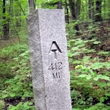
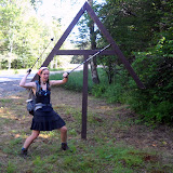
Southern PA was very flat and easy. It got rocky only in the last couple days, and it was a full variety of large boulders, rocks, and fist size angular cobble. All making it really hard to maintain a steady pace and not stress ankles/feet.
May 20 stayed at Peters Mtn. Shelter. There was a large black snake on the porch all evening. After dark it started crawling inside the shelter to try to get to a bird nest. I knew it wouldn't harm me, but it made me uneasy. LOTS of chipmunks on the trail--shrieking as the run away from you. I've also seen 3 rattlesnakes, all in the middle of the trail...they rattled when they saw me and refused to move, so I had to go off trail to get around them. One rocky ridgeline was COVERED in poison ivy. I tried to use my poles to keep the plants away as I hiked, but I'm sure I hit some. We'll see if I'm immune or not. It was impossible to avoid it.
May 22, Rather than staying at 501 shelter (right next to a busy road, full of boy scouts and thru hikers), I hiked an extra 6 miles to camp by a stream (near some more boyscouts). They saw me go by, and later came down to my site and said, "This may seem weird, but we have too much food, and we thought that since you're a long distance hiker you might want some extra fresh food. Here's a fresh, cooked trout". !! It was DELICIOUS!!! Gotta love trail magic!
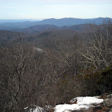
"Rocksylvania" lived up to its reputation the last couple days in the state. It helped to pretend I was just walking along the rocky Maine coast, since there were few views from the ridges. There was a really nice climb out of Lehigh Gap (supposedly the hardest climb until New Hampshire...I guess it's going to stay fairly easy until then!). It was steep boulders and ledges...but a pretty short section. Then you get up onto a ridge-line that has been decimated by zinc mining (very little vegetation). The tics are out in full force, as are midges. I've given up staying in shelters because they kept me up a couple nights.
May 27, hiked into Delaware Water Gap with Mouse and Wazi. We got poured on right before town. Decided to split a motel room rather than stay in the crowded hostel (a good thing, because some drunken craziness occurred that night we heard). Showered, then went to Stroudsburg to see a movie (Robin Hood) for a break. Hung around in town until 2pm with Mouse, Yukon, and Litterbox. Good bye to Pennsylvania!!!
Showing posts with label trail magic. Show all posts
Showing posts with label trail magic. Show all posts
Monday, May 31, 2010


New Jersey
May 28, State #8 New Jersey. Rocky, but not as bad as PA. Way more views too. I've felt since the end of the Shenandoahs that the trail is just a connector between the southern mountains and New England. I wonder when I'll feel that the trail itself is a destination again. I'm getting tired of these long, view-less ridges and easy walking. I want to do some real mountain climbing again! Passed Sunfish Pond...the southernmost glacial pond on the AT. Very pretty, but plastered with No camping and No swimming signs. I finally met Rocker, Rooster, Snow White, 40oz (they've been just ahead of me the whole trip).
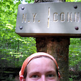
May 30, took the side trail to New Jersey's highest point, home to a large obelisk monument (like the Washington Monument in DC). I climbed up the humid tower but the views were almost the same as from the base. This afternoon the trail dropped off the ridge into farmland and swamps. I got to Unionville NY to resupply and camp in the park, only to find out there's no camping anymore. Luckily the Outhouse Hostel is in town. $10 donation for bunk, shower, laundry, dinner, and breakfast. Sweet deal, plus a southbounder I met on the road right before here paid for me. Trail Magic!!!
May 30, took the side trail to New Jersey's highest point, home to a large obelisk monument (like the Washington Monument in DC). I climbed up the humid tower but the views were almost the same as from the base. This afternoon the trail dropped off the ridge into farmland and swamps. I got to Unionville NY to resupply and camp in the park, only to find out there's no camping anymore. Luckily the Outhouse Hostel is in town. $10 donation for bunk, shower, laundry, dinner, and breakfast. Sweet deal, plus a southbounder I met on the road right before here paid for me. Trail Magic!!!
Wednesday, May 12, 2010
Halfway! (psychologically)
[In her own words]
So I've now made it through the Shenandoahs. Everyone said the Shennies were easy and flat. Well, the trail was well-graded (few rocks or roots, nice gravel surface), but it wasn't flat. Relative to most of the rest of the trail, yes, but not flat. There were also not very many views. When the trail crossed the Skyline Drive (28 times in total) near an overlook you got a view. But I was hiking with some fun guys--Mellow Yellow and Sockburn. Also known as the Shenandoah National Petting Zoo, I saw a lot of deer who were not timid of people. Lots of squirrels. And 3 bears...cubs. They were up a tree and ran down and away as I approached. My attempts at "yogi-ing" (getting free food from non-hikers by looking hungry) failed. Partly because some of the campgrounds weren't open yet, but mostly because not many people were around. I did stop at one of the many trail-side Waysides (rest stops/cafe/gift store) and had a blackberry milkshake. It was excellent but severely overpriced.
May 10. A Trail Magical Day. I walked into Linden, VA to pick up my mail drop, and I had 5 packages!! The expression on the postal clerk's face as he handed them to me was priceless. I ate a lot of it on the spot, and shoved the rest in my pack for eating on the trail. Thanks everyone! Right before heading into town, there were a bunch of sodas and beers in the stream, but being 8am I decided to leave them for later hikers. I stopped at Manassas Gap shelter for lunch, where a group of Japanese day hikers were having a feast (including fish, seaweed wraps, etc.) and they gave me a short rib. I found a book at the next shelter (I had finished mine last night). Then there were oranges and root beer along the trail in the afternoon. Crazy amount of trail magic for one day.
May 11. 50 degrees and rain and gusty wind. I hiked across the Roller Coaster section (13.5 miles of steep ascents and descents) with tree branches blowing down all around me. The trail corridor is really narrow (hemmed in by private land), so the trail builders had little choice on where to put the trail). It was a harder section, but not too bad overall. I think the hardest part was crossing the 4 lanes of VA 7...in the pouring rain. I stayed at the Blackburn Trail Center (run by the Potomac AT Club), where they have a free hostel with wood stove (Heat!!), and the caretaker fed us spaghetti, home made bread, chocolate cake, and ice cream. It was a good night, even though I slept on the porch because it got way too hot inside.
May 12. Harpers Ferry. The psychological half way point of the trail. The first NOBO to come through this year was Nature Boy (remember him? he got stuck in the snow in VA, and was day hiking in GA when I started) on April 4. I am #55, and the 7th female (3rd hiking solo) to arrive. I toured the historic section of town this afternoon, had a huge cookies and cream milk shake, and am heading to my cousin Sarah's place in Baltimore tonight. I'm looking forward to a shower and laundry!! 1014 miles down, 1165 to go!
So I've now made it through the Shenandoahs. Everyone said the Shennies were easy and flat. Well, the trail was well-graded (few rocks or roots, nice gravel surface), but it wasn't flat. Relative to most of the rest of the trail, yes, but not flat. There were also not very many views. When the trail crossed the Skyline Drive (28 times in total) near an overlook you got a view. But I was hiking with some fun guys--Mellow Yellow and Sockburn. Also known as the Shenandoah National Petting Zoo, I saw a lot of deer who were not timid of people. Lots of squirrels. And 3 bears...cubs. They were up a tree and ran down and away as I approached. My attempts at "yogi-ing" (getting free food from non-hikers by looking hungry) failed. Partly because some of the campgrounds weren't open yet, but mostly because not many people were around. I did stop at one of the many trail-side Waysides (rest stops/cafe/gift store) and had a blackberry milkshake. It was excellent but severely overpriced.
May 10. A Trail Magical Day. I walked into Linden, VA to pick up my mail drop, and I had 5 packages!! The expression on the postal clerk's face as he handed them to me was priceless. I ate a lot of it on the spot, and shoved the rest in my pack for eating on the trail. Thanks everyone! Right before heading into town, there were a bunch of sodas and beers in the stream, but being 8am I decided to leave them for later hikers. I stopped at Manassas Gap shelter for lunch, where a group of Japanese day hikers were having a feast (including fish, seaweed wraps, etc.) and they gave me a short rib. I found a book at the next shelter (I had finished mine last night). Then there were oranges and root beer along the trail in the afternoon. Crazy amount of trail magic for one day.
May 11. 50 degrees and rain and gusty wind. I hiked across the Roller Coaster section (13.5 miles of steep ascents and descents) with tree branches blowing down all around me. The trail corridor is really narrow (hemmed in by private land), so the trail builders had little choice on where to put the trail). It was a harder section, but not too bad overall. I think the hardest part was crossing the 4 lanes of VA 7...in the pouring rain. I stayed at the Blackburn Trail Center (run by the Potomac AT Club), where they have a free hostel with wood stove (Heat!!), and the caretaker fed us spaghetti, home made bread, chocolate cake, and ice cream. It was a good night, even though I slept on the porch because it got way too hot inside.
May 12. Harpers Ferry. The psychological half way point of the trail. The first NOBO to come through this year was Nature Boy (remember him? he got stuck in the snow in VA, and was day hiking in GA when I started) on April 4. I am #55, and the 7th female (3rd hiking solo) to arrive. I toured the historic section of town this afternoon, had a huge cookies and cream milk shake, and am heading to my cousin Sarah's place in Baltimore tonight. I'm looking forward to a shower and laundry!! 1014 miles down, 1165 to go!
Sunday, March 14, 2010
Rain, Rain...
Saturday, March 13, about 4pm, Emily called from the Blueberry Patch Hostel in Hiawassee, GA, while her sleeping bag dried near the wood stove.
On Thursday she had hiked 11 miles in rain to Low Gap, astounded by the amount of trash she's seen along the Trail and in shelters. She's not preachy, but indoctrinated in Leave No Trace ethics and accustomed to more pristine trails in Maine and New Hampshire, she was moved enough to write about it in one of the Trail registers.
Friday's 15 mile hike in more rain, and thunderstorms, was tremendously brightened after a steep descent from Blue Mountain: at Unicoi Gap there was a truck draped in a banner advertising AT Trail Magic, a generous array of goodies that don't travel well in packs, including a Tastee Cake (spelling?) that Em was enjoying while she talked to me on the phone. Thanks to Linda and Wayne of Cleveland, GA, for the boost! It helped ease the hike over Tray Mountain, "treacherous," Em said, on both sides of the peak: clear ice patches interspersed with remnant patches of crunchy snow. During the night at Tray Mt shelter, a huge thunderstorm produced such bright lightning that, with eyes shut, it seemed as bright as daylight.
Saturday the 13th: 11 miles in rain and sleet, around and through a lot of blowdowns. Apparently it's too early for maintainers to have been able to work on their sections. This morning she woke up cold. After three days and two nights in the rain, with high temp's maybe 54 degrees, drying gear inside the sleeping bag at night produced condensation. She said,"You don't take many breaks. You just want to hike to your base for the night and get out of the rain." Her legs are fine, the one blister is no worse, a couple hot spots are under control, and her spirits are very good. She came off the Trail at Dick's Creek Gap, where a hiker had just given up his seat on a shuttle in favor of an alternate plan, so Em hopped in and got a free ride to Hiawassee. There weren't many other hikers in the hostel needing drying space, so she was able to dry out her tent and fly.
Sunday, March 14, still raining, but back on the Trail to cross the North Carolina border only nine miles ahead.
On Thursday she had hiked 11 miles in rain to Low Gap, astounded by the amount of trash she's seen along the Trail and in shelters. She's not preachy, but indoctrinated in Leave No Trace ethics and accustomed to more pristine trails in Maine and New Hampshire, she was moved enough to write about it in one of the Trail registers.
Friday's 15 mile hike in more rain, and thunderstorms, was tremendously brightened after a steep descent from Blue Mountain: at Unicoi Gap there was a truck draped in a banner advertising AT Trail Magic, a generous array of goodies that don't travel well in packs, including a Tastee Cake (spelling?) that Em was enjoying while she talked to me on the phone. Thanks to Linda and Wayne of Cleveland, GA, for the boost! It helped ease the hike over Tray Mountain, "treacherous," Em said, on both sides of the peak: clear ice patches interspersed with remnant patches of crunchy snow. During the night at Tray Mt shelter, a huge thunderstorm produced such bright lightning that, with eyes shut, it seemed as bright as daylight.
Saturday the 13th: 11 miles in rain and sleet, around and through a lot of blowdowns. Apparently it's too early for maintainers to have been able to work on their sections. This morning she woke up cold. After three days and two nights in the rain, with high temp's maybe 54 degrees, drying gear inside the sleeping bag at night produced condensation. She said,"You don't take many breaks. You just want to hike to your base for the night and get out of the rain." Her legs are fine, the one blister is no worse, a couple hot spots are under control, and her spirits are very good. She came off the Trail at Dick's Creek Gap, where a hiker had just given up his seat on a shuttle in favor of an alternate plan, so Em hopped in and got a free ride to Hiawassee. There weren't many other hikers in the hostel needing drying space, so she was able to dry out her tent and fly.
Sunday, March 14, still raining, but back on the Trail to cross the North Carolina border only nine miles ahead.
Wednesday, March 10, 2010
The Shake Down
[Transcriber's note: I can't quite bring myself to pretend to be Emily by using language such as "I" or "my" it just feels weird. Maybe if you didn't know I existed it would be easier. Anyway, I'm going to write in third person, and you're just going to have to deal with it.]
On day two, Emily put down another 10 miles and found a place to camp on the ridge line and spent the night in solitude. Apparently there is a wildfire off in the distance, because she told me she could see the smoke from her camping spot.
So far the weather has been warm enough to hike in shorts and a tee shirt during the day, but some rain is on the way and so is a cold front. =(
In the "good news" category we have several things to mention. First is that Emily experienced her first Trail Magic - brownies! A kindly day hiker thought ahead and brought treats to the trail. Also a bag of apples was found, the details of which I was not told.
On the evening of March 8th, Emily arrived at Neels Gap, 30.5 miles from Springer Mountain. She stayed at the Walasi-Yi Hostel for 2 nights. While in Neels Gap it's necessary for one to visit Mountain Crossings outfitter. This gear store and more is unique in it's position and catering to AT hikers. Going in originally for a new rain cover for her pack, Emily came out with quite a bit more. She got a gear shake down which includes first weighing one's pack.... Emily's weighed 50 pounds! Yikes! The experts at Mountain Crossings were able to help her pare it down to just 35 lbs. This included the (unexpected and slightly expensive) purchase of a new pack. It might be worth it though, if it saves your back and knees and feet and neck and arms and hips and...
No pictures yet, due to technical difficulties. If we were going for 'typical hiker' we should have gotten her a smart phone. Apparently everyone else is online whenever and where ever they want. But how good of a picture can you take with a camera phone? High quality pictures on the way.
On day two, Emily put down another 10 miles and found a place to camp on the ridge line and spent the night in solitude. Apparently there is a wildfire off in the distance, because she told me she could see the smoke from her camping spot.
So far the weather has been warm enough to hike in shorts and a tee shirt during the day, but some rain is on the way and so is a cold front. =(
In the "good news" category we have several things to mention. First is that Emily experienced her first Trail Magic - brownies! A kindly day hiker thought ahead and brought treats to the trail. Also a bag of apples was found, the details of which I was not told.
On the evening of March 8th, Emily arrived at Neels Gap, 30.5 miles from Springer Mountain. She stayed at the Walasi-Yi Hostel for 2 nights. While in Neels Gap it's necessary for one to visit Mountain Crossings outfitter. This gear store and more is unique in it's position and catering to AT hikers. Going in originally for a new rain cover for her pack, Emily came out with quite a bit more. She got a gear shake down which includes first weighing one's pack.... Emily's weighed 50 pounds! Yikes! The experts at Mountain Crossings were able to help her pare it down to just 35 lbs. This included the (unexpected and slightly expensive) purchase of a new pack. It might be worth it though, if it saves your back and knees and feet and neck and arms and hips and...
No pictures yet, due to technical difficulties. If we were going for 'typical hiker' we should have gotten her a smart phone. Apparently everyone else is online whenever and where ever they want. But how good of a picture can you take with a camera phone? High quality pictures on the way.
Subscribe to:
Posts (Atom)