April 1 (Day 26)
A brief conversation with a couple day hikers brought out an excited “Oh! The blueberry pie at.... that place...” “Yeah, Helen's.”
The ridge line over Big Fire Scald Bald was rocky and exposed ledge. Trail notes warned of an 8 foot vertical scramble requiring the use of hands. Emily met a SOBO (SOuth BOund hiker) who earnestly advised that she avoid it by hiking the bad weather bypass. Emily did not follow his advice. That night she wrote in the Shelton Graves register, “That was a nice taste of NH and ME, but where was the so-called 'scramble'?” Not trying to be a wiseguy, but just letting NOBOs (NOrth BOund hikers) know what's ahead.
April 2 & 3
“Why am I sweating when I'm going DOWNhill?” Someone said it was 83 degrees; another source claimed it was 87. Early spring flowers are blooming, but there are no leaves yet on the trees. When she needed to rest, she'd find a tree with a big enough shadow that she could be entirely out of the sun. After a while, she said, “It felt like my shadow didn't want to leave the shade.” and, thinking further of Peter Pan, “Wouldn't it be nice if we could hike in our own shadow all day!” Since that's not an option, daydreams of ice cubes, ice cream, and SCUBA diving in the Gulf Of Maine kept Emily hiking through the heat.
Spring weather on the AT is just as changeable as the terrain. Hiking over Big Bald was so windy that, leaning into the wind, she could feel her pack lurching sideways. Brown grass, brambles and hawthorns reminder her of Oregon. She spent the night in Erwin, TN.
April 4
Today's hike ended “kinda like Maine”. Emily camped on Unaka Mt. Covered with red spruce that “smelled really nice.” There were some scraggly blowdowns to negotiate: “You know what THEY'RE like!”
April 5
This 18.9 mile day ended after a 2000 foot ascent to the highest shelter (6,275 feet) on the AT, Roan High Knob, TN. The last mile of trail was covered with a foot and a half of rotten snow over an inch and a half of flowing water. [We spelled that out so there would be no doubt in your mind about how wet and messy it was!] Since she couldn't avoid breaking through it, Emily channeled her frustration into “stomping the snow to oblivion” thinking it might be helpful to hikers following her.
April 6
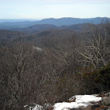
Leaving Roan High Knob was nasty, cold and messy on a muddy trail that had more water running down it than some of the streams she surveyed in OR last summer. It seemed there were blowdowns every ten steps! Grassy balds later in the day gave a reward of really nice 360 views. Emily investigated a box of pamphlets promoting an adopt-a-goat effort: when the grass turns green goats are brought here to graze, preserving the grassy balds by preventing blackberries from taking over. That night she camped on the NC/TN State Line at Doll Flats [Editor's note: The AT runs along the border of NC and TN for many miles, often crossing back and forth. Emily is not back tracking or lost, people just thought the mountains made a nice state border at that point.]
April 7
Our favorite experienced map reader and trail finder was confused! The original AT went straight up over and down the ridge lines. Apparently the atmosphere in the neighborhood of the Buck Mt Road gave cause for relocation of the trail, accomplished with a section of “ridiculous” switchbacks that cross and re-cross the original trail. The problem is that the original blazes aren't covered up, so a hiker can find the familiar white blaze in ALL directions at some intersections. Sometimes a few “skinny little sticks” were discernible as blocking the old pathway. Emily's guide was to know whether she should be going uphill or down, rather than going along with other hikers.
April 8
The day brought some rain, but Laurel Fork Falls is “really really pretty.” By the end of this day, Emily had hiked a total of more than 400 miles. This night at Laurel Fork shelter was her first encounter with inconsiderate hikers: oooh and is she ever grumpy when her sleep is interrupted for no good reason! Bears beware, there's a sleep deprived Emily in these parts.
April 9, 10, 11
Emily took it easy these days: she wanted to be in Damascus, VA on a Monday rather than a Saturday or Sunday, because of business hours. So in spite of the long, flat ridge line from Erwin or Hampton TN, which bears the nickname “the Tennessee Turnpike,” she didn't cruise. Some call it “the Damascus Dash.” Trail gossip said that one guy pushed 50 miles on 12 Snickers bars and ended up paying for it with an unplanned day in Damascus. Since Emily's not traveling that fast, she's spotted turkeys, deer, a barred owl, a snake, and robins, juncos, wrens, and thrushes. She can't name the flowers, but several remind her of Maine varieties.
April 13
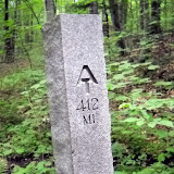
After a refreshing resupply in Damascus, VA, 463.5 miles from the starting point of Springer Mt GA, Emily is “heading out to rack up some big mile days!”
Showing posts with label NC. Show all posts
Showing posts with label NC. Show all posts
Saturday, April 17, 2010


Thursday, April 1, 2010
Day 14 3/20
Started the morning with breakfast at the restaurant – sweet potato griddle cakes (gooey), eggs and sausage. The Nantahala River is about 44 degrees. Climbed from 1700' at the rive to 5062' on Cheoah Bald – moderate terrain with a few steep bits. Nice view of the river from the Jump Up. I could even hear the tourist train's whistle. Had lunch on Swim Bald (wooded). First register in a shelter in NC at Sassafras Gap. Sofa caught up to me there – he is starting to have shin splints. The view from Cheoah Bald south was lovely, especially thanks to the folding lawn chair on top. Mountains to the horizon were blue and hazy. Steep ridges, pointy peaks. I hiked 10.5 miles to Locust Cove Gap to tent camp there.
Day 17, 3/23
Nice night in the Hilton, despite one loud snorer. Dragged all morning with low energy, everyone was passing me. Started out cold, cloudy. Hiked into the clouds and then the sun burned thru right in time for Shuckstack Mtn. I only climbed up one tier of the wooden stairs of the tall narrow tower, but the views were excellent. Climbed more than 3000 ft today. Almost stayed at Mollies Ridge, but it was such a GORGEOUS day I decided to move on. Had a snack and got a nice surge of energy to cruise (singing and whistling Colonel Bogey Bridge over River Kwai) to Russell Field Shelter, 13.8 miles. The shelter is stone, with a chain link fence on the front. Photos of : Fontana Lake, AT sign (green is common in NC), Fontana Dam, Below the dam, me entering the Smokies, Fontana Lake, Hollywood disappearing into the mist, Smokies, view from Shuckstack Mtn, Firewardens cabin remains, Russell Field Shelter. Tonight at the shelter: Picker, Cornpatch, Nate-dog, Thrasher and Turkey, Pace car, Guidefoot and Dad, Dr. John (a geology major who's been to Norway and Iceland).
Day 18 3/24
Hiked 16.4 miles today. Glorious weather – I think my arms are sunburned again... I should probably get some sunscreen in Hot Springs. Really nice views from Rocky Top *sings Rocky Top song* and Siler's Bald. The trail was slushy snow or soupy mud most of the day. Lots of snow from Derrick's Knob Shelter to Double spring Gap. I had a 1 hour lunch at Derrick Knob – nice stone shelter with plexiglass sky lights (so is Double Spring). Nate-dog, Picker, Cornpatch, Pace Car, Guidefoot, and Boomhouer hiked with me til lunch, and Mike. I caught up to Dr. John in the pm and hiked with him thru the snow. Saw my first slug this morning. First fir trees too on Jerkins Ridge (Fraser firs and spruce). Really pretty. Nice views of Clingmans's Dome. Tonight with Picker, Hollywood, No Point, Wanderer and Walleye, Dr John is texting.
Day 19 3/25
13.8 miles to Icewater Spring Shelter. In snow all the way except for half mile near Newfound Gap. Snowed on Clingman's Dome, sunny and rain at the same time on the way down. Windy all day. Cold evening with rain. Hollywood, Picker, Mike, and 3 other guys plus 3 section hikers in for the night. 1972 miles to Katahdin!
Day 20 3/26
Hiked 12.6 miles in the snow and ice and wind and rain to Tri-Corner Knob Shelter. I started in the rain, so I zipped down to shorts, then ended up on an exposed and windy ridge for a while. BRRR! Lots of firs and spruces, beautiful ridge walk, but no views because of the clouds. I want to come back to the section in snow free weather. Got to the shelter ~ 2:30, crawled into my sleeping bag to warm up. Crawled out ~ 6:30 for dinner. The sun had come out and all the grees are sparkling with ice. Very pretty – it's like the diamond forest in 12 Dancing Princesses. Springer Mtn to Fontana = 7% of AT hiked, 50% of hiker drop out by then. Highest point on AT is Clingman's Dome, 6625'. AT runs for 35 miles without dropping below 5000 ft (that's why it's so cold and snowy!) Normally when I approach hikers from behind I click my poles together to let them know I'm there. Today my poles iced up so I couldn't click them.
For those following my trip who aren't backpackers, here is a sample day of winter hiking (like my first 4 days in NC and the Smokies): Wake up ~ 7am, Grab fleece jacket and gloves from inside sleeping bag. Option A – scurry to the privy ASAP. Option B – find head lamp and put in contact lenses. Next, take off long johns and put on pants (also kept in sleeping bag). Take off wool socks, cover up any blisters or “hot spots” (potential blisters) with mole skin, gauze, or duct tape. Put on socks from the day before (from sleeping bag). Go to privy. On way back to shelter, retrieve food bag from bear cables. Get pot, stove, fuel from pack (which was used as a pillow) and cook 2 packets of instant oatmeal for breakfast. Pack up everything and strip down to tee-shirt and long sleeve shirt, fleece hat, shorts, knee high gaiters, boots, and yaktrax. Get hiking ASAP because it's COLD! Hike ~ 30 minutes then trade hat for bandana (around neck since the night before). Hike for 7-8 hours, stopping for lunch if it's nice, or snacking on the way if it's cold. Roll into a shelter in the afternoon after hiking 12-15 miles in snow. Claim a spot with my sleeping pad, fill my water bag and treat water with chlorine drops. Refill hydration bladder and small nalgene. Visit privy, change out of boots and wet socks. Put on long johns, pants, dry socks, long john top, long sleeve shirt and fleece jacket (plus rain pants and jacket if it's really super cold). Set veggies, etc, to soak in pot while I spread out sleeping bag and get ready for the night. Cook dinner followed by hot cocoa. Visit privy one last time, crawl into sleeping bag THEN strip down to long johns. Read for a bit and finally sleep. Repeat the next day. =)
For those following my trip who aren't backpackers, here is a sample day of winter hiking (like my first 4 days in NC and the Smokies): Wake up ~ 7am, Grab fleece jacket and gloves from inside sleeping bag. Option A – scurry to the privy ASAP. Option B – find head lamp and put in contact lenses. Next, take off long johns and put on pants (also kept in sleeping bag). Take off wool socks, cover up any blisters or “hot spots” (potential blisters) with mole skin, gauze, or duct tape. Put on socks from the day before (from sleeping bag). Go to privy. On way back to shelter, retrieve food bag from bear cables. Get pot, stove, fuel from pack (which was used as a pillow) and cook 2 packets of instant oatmeal for breakfast. Pack up everything and strip down to tee-shirt and long sleeve shirt, fleece hat, shorts, knee high gaiters, boots, and yaktrax. Get hiking ASAP because it's COLD! Hike ~ 30 minutes then trade hat for bandana (around neck since the night before). Hike for 7-8 hours, stopping for lunch if it's nice, or snacking on the way if it's cold. Roll into a shelter in the afternoon after hiking 12-15 miles in snow. Claim a spot with my sleeping pad, fill my water bag and treat water with chlorine drops. Refill hydration bladder and small nalgene. Visit privy, change out of boots and wet socks. Put on long johns, pants, dry socks, long john top, long sleeve shirt and fleece jacket (plus rain pants and jacket if it's really super cold). Set veggies, etc, to soak in pot while I spread out sleeping bag and get ready for the night. Cook dinner followed by hot cocoa. Visit privy one last time, crawl into sleeping bag THEN strip down to long johns. Read for a bit and finally sleep. Repeat the next day. =)
Day 21 3/27
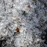
Woke up this morning to COLD! My boots were frozen! The ice was glittering on all the trees on the North side of the ridge and the wind was blowing chunks off. The trail was covered in the chunks – it was like walking through an inch of ice cubes. The usn was out all day. I hiked .6 miles to the Mt. Cammerer fire look out – gorgeous 360 degree views of the Smokeis, the valley to the North and West, etc. A bunch of day hiker were up there. Right before Cosby Knob I dropped below the snow line for the rest of the day. The birds were singing, I saw a snake and a snail – it's spring! Tonight = 2600' above sea level – Davenport Gap Shelter – 14.8 miles and 1.2 side trail to tower. Picker, Hopi, Hollywood, and Mike at the shelter.
Subscribe to:
Posts (Atom)