Emily is at Abol Bridge today...will do the next to last section tomorrow...Barb & Rob come Tuesday...looks like Mt. Katahdin will be later in the week to finish her 2,179 mile trek from Georgia!!!
Coming to you from the Appalachian Trail Cafe in Millinocket, Maine.
Monday, August 2, 2010


Monday, July 26, 2010
Mountains of Maine
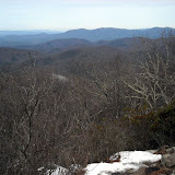
I had beautiful weather crossing the high peaks of Maine. Last time I hiked most of those peaks was up to 14 years ago (my first ever backpacking trip, over the Crockers and Sugarloaf!), so I had remembered the trail as being VERY tough. It definitely was rugged, but I had a lot of fun hiking through them. I saw a MOOSE on Spaulding Mountain ridge. I beat my dad to the trail work site just north of Rt. 27 near Stratton (and he only had to day hike 5 miles to the site. I walked 12 miles). We helped to install some new bog bridging with some other AMC/MATC (Maine Appalachian Trail Club) folks. It was fun to give back to the trail, while still on my thru-hike. My dad then joined me to cross Bigelow Mountain—my favorite in the state. We had gorgeous weather, but it was a little too hazy to see Katahdin. We even found the machete used by Myron Avery when doing trail work!! Myron Avery, of North Lubec, Maine, was one of the founding fathers of the Appalachian Trail. He is responsible for laying out most of the original trail in Maine, and for getting the trail into Maine in the first place (the northern terminus was originally going to be Mt. Washington, NH). Bigelow was Avery's favorite mountain, so when he passed away his family cemented his machete near the summit of Bigelow.
Flatlands of Maine
My dad hiked with me for about a week through the ponds and swamps. We heard lots of loons and saw lots of toads, frogs, and mushrooms. The blueberries are ripe—making a lovely addition to our morning oatmeal. There are amazingly few biting insects out this year. We stopped to admire several bogs and didn't get chewed up. We crossed the Kennebec River—a dangerous ford because of the hydroelectric dam upstream that can release large volumes of water. MATC has provided a canoe ferry (and ferryman) to help hikers across. We did have to ford the East and West Branches of the Piscataquis River...but they were easy. Knee deep, gentle current, warm water. I'm taking a zero day in Greenville with my parents before heading into the 100-mile Wilderness. I'm taking my time and enjoying the rest of my trip, so several of my northbound friends have caught up and passed me. It sounds like August 1 is a popular summit day, but I will be on Katahdin a few days after that.
100 Mile Wilderness
A remote stretch of trail accessed only by logging roads, the trail winds past several pretty ponds and waterfalls, crosses (fords) several streams, and climbs a couple 3000 foot mountains. I'm looking forward to my first view of Katahdin (from Gulf Hagas Mtn.), and watching the sunrise next to Katahdin over Rainbow Lake. My dad is meeting me part way through to resupply me, and then I'll hike up to Baxter State Park to join him and my mom and brother. Rob is planning to summit the Big K with me.
114.5 miles to go!!
114.5 miles to go!!
Saturday, July 24, 2010
July 12
Slackpacked (hiked with just lunch and rain gear) over Baldpate with beautiful weather. I'd forgotten how steep that mountain is! I met my parents at a road crossing to pick up my camping gear and hiked in to Surplus Pond for a quiet night. I woke up to a moose feeding in the pond, followed by swimming across the width of the pond. All the Sobos had warned us about how horrible the trail was on Moody Mountain. Last spring one side of the mountain slid off, and they have temporarily re-routed the trail around the slide. I was expecting the worst, but it was actually only a couple hundred feet of detour. The trail is still steep and eroded in places, but not as horrendous as I had heard. Hiked over Old Blue and Bemis on Thursday. The trail is ROUGH. Rocks, roots, mud. They need to install more bog bridging on the ridgeline! Met my parents at route 17 and slackpacked 14 miles with Moonpie and Doozy to route 4 through the muddy bogs. They even managed to fall in up to their waists in one bog (thanks to faulty bog bridges, and a lack of bog bridges). One last night in a campground with my parents, and then I'm on my own for the high peaks of Maine. I'll meet up with Dad right before climbing Bigelow Mountain (Sunday), and he'll hike with me for about a week (to Monson).
Saturday, July 17, 2010
July 9th - The Mahoosucs
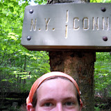
I headed up into the rugged and remote Mahoosuc Range with Moonpie and Doozy. We got flooded out of the tent sites at Trident Col, but the rain let up part way through the next day. I hiked this section with my brother in 2003, but it seemed a lot easier this time around. Probably something to do with the 1900 miles of experience...The trail was still wet, rocky, rooty, and technically challenging. Crossed into State #14, MAINE!!!!! on July 10. I'm glad to be in my home state! Woke up on July 11 to SUNSHINE!! When I dropped down into the infamous Mahoosuc Notch I was very impressed to find DRY rocks. Mahoosuc Notch is touted to be the hardest mile of the whole AT, as the trail winds through a boulder-choked chasm. You have to climb over, around, and under boulders as big as trucks. I enjoyed the challenge of making it through on my own (last time my brother scouted routes and helped me though most of it). The dry rocks helped loads. It took me about 1.5 hours to do 1 mile. Slowest mile on the AT, most technically challenging too. Steep climb up Mahoosuc Arm and Old Speck, from which I got lovely views. My parents met me at Grafton Notch with trail magic, and even gave Moonpie and Doozy a ride to town. I'll be light-packing for a couple days, meeting my parents at road crossings each day for food resupply. Psyched to be out of AMC land (Appalachian Mountain Club, or Appalachian Money Club, as they are known to many thru-hikers) and entering MATC territory (Maine Appalachian Trail Club, home of FREE shelters and campsites).
July 8th
Although the Presidentials get most of the hype, the trail along Wildcat Ridge was really rugged. The climb out of the notch was really steep (plus it was really humid and hot day—I woke up at 5:30am sweating already!). Stopped in to visit Carter Notch Hut—the hut croo (college-aged kids who staff the huts each season) were really friendly and gave me some free baked goods. They also showed me their Ice Cave. About 2 minutes from the hut is a big cleft in the rock, which holds ice for most of the summer. It was probably used a fridge at the hut before they got power. It was very refreshing to stand inside the “air conditioned” cave for a little while. I was impressed with Mt. Moriah—very nice views from its rocky top. Ran into Moonpie and Doozy—I hadn't seen them since the Delaware Water Gap! I also saw Roaring Lion and Rocker.
July 5th
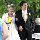
After a lovely wedding in Bethel and TWO zero days with my parents at Dolly Copp Campground, I hit the trail in Crawford Notch with Jerry (chemistry prof at UNE). We headed into the Presidentials with a wonderful weather forecast. Unfortunately on the second day we woke up to summits in the fog...with winds gusting up to around 60mph. That's enough to knock you sideways, and off your feet if you stumble. We had an ambitious 12 mile day planned, hitting all the mountain peaks along the ridgeline (Clinton, Eisenhower, Washington, Clay, Jefferson, Adams). We had lunch on Washington, and luckily as we descended the clouds started to lift. By the time we reached Jefferson we had clear views. The timing worked out well, as I had never hiked on the northern half of the Presies before, so that's where the views mattered most. Jerry got off at Pinkham Notch to head home, and I finished out the Whites through the Carter-Moriah Range.
Subscribe to:
Posts (Atom)