Hey everyone,
Check out the January/February issue of AT Journeys (the ATC publication) for an article about the historic re-enactment on Katahdin! Kylie...you're in the photo, so make sure you check it out (I wish I had your e-mail/address)!
Tuesday, November 30, 2010


Tuesday, August 10, 2010
THANK YOU!!!
Now that my trip has reached an end, I want to thank everyone who helped me along the way. Everyone that I met in the trail community was so friendly and helpful! Thanks to everyone who sent me care packages along the way, or left words of encouragement on my blog site or with my parents. Just knowing that I had so many family and friends following my trip helped me through the tougher parts of the journey. Thanks to those who hiked with me and met me at road crossings, especially my parents. Throughout Maine I had personalized trail magic: they met me at every road doing the "trail magic hop", resupplying me, getting me dried out if it rained. Although I did the hiking, it's thanks to everyone who supported me that I made it all the way to Maine, and had fun along the way. And of course a HUGE thank you to Liz, my webmaster and blogger :-)
Monday, August 9, 2010
GAME 10
(Georgia to Maine, 2010 in hiker short-hand)
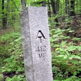
March 7 I stood on Springer Mountain looking north. August 6 I stood on Katahdin. 2,179.1 miles and 5 months of hiking through spectacular scenery, meeting wonderful people along the way. Many people hike the trail for profound reasons. In the words of Benton MacKaye, one of the founders of the trail, I hiked the trail “to walk, to see, and to see what I see”. Watching the seasons progress from winter to summer, from south to north, seeing the leaves unfurl, the flowers bloom, the mushrooms emerge. The first time I climbed Katahdin almost 10 years ago, and saw the white blazes headed south, I wanted to know what the trail looked like and what it passed through on the way to Georgia. Now, standing on Katahdin looking south, I know where the trail goes. I really enjoyed the hike, and I think the trail was a perfect length for me. I can't see myself doing another hike of this length, but I'm already reading about some shorter (maybe a month or so) long trails for my next excursion :-) However, right now I'm ready to move on to my next adventure—Newfoundland!
March 7 I stood on Springer Mountain looking north. August 6 I stood on Katahdin. 2,179.1 miles and 5 months of hiking through spectacular scenery, meeting wonderful people along the way. Many people hike the trail for profound reasons. In the words of Benton MacKaye, one of the founders of the trail, I hiked the trail “to walk, to see, and to see what I see”. Watching the seasons progress from winter to summer, from south to north, seeing the leaves unfurl, the flowers bloom, the mushrooms emerge. The first time I climbed Katahdin almost 10 years ago, and saw the white blazes headed south, I wanted to know what the trail looked like and what it passed through on the way to Georgia. Now, standing on Katahdin looking south, I know where the trail goes. I really enjoyed the hike, and I think the trail was a perfect length for me. I can't see myself doing another hike of this length, but I'm already reading about some shorter (maybe a month or so) long trails for my next excursion :-) However, right now I'm ready to move on to my next adventure—Newfoundland!
August 6, 2010
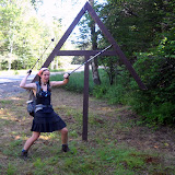
Up early to beat the crowds, Rob and I headed up the Hunt Trail for the last 5.2 miles of my Appalachian Trail thru-hike. The summit was in and out of clouds, but we had made arrangements with Pamola (Keeper of Katahdin, a creature with the head of a moose, wings and feet of an eagle, and torso of a man) for clear skies from 11 to 1, and he kept to his word. We met some thru-hikers coming down across the Tableland....including Picker!! It was really great to see him again. I hadn't seen him since Pearisburg, VA! At the summit Rob and I re-staged a historic photo of Myron Avery and his measuring wheel (I packed a converted bicycle wheel up the mountain with me), and attracted a LOT of attention. We came down via the Knife Edge and Dudley, probably the hardest way off the mountain, but it was fun.
100 miles to Katahdin
The last 100 miles of trail in Maine (the famed Wilderness) went quickly. I had hiked the section two years ago with Liz, so I remembered a lot of the trail, and I was in between thru-hiker bubbles (hiking alone). I had excellent hiking weather, watched the loons on numerous lakes, and even saw a bear! The last night I tented on the shore of a lake and watched the sun rise over the shoulder of Katahdin. It was magical. My folks all met me in Baxter State Park, where we waited a day for good weather. In the meantime my brother and I climbed Doubletop Mountain and went swimming at the natural rock slide at Ledge Falls on Nesowadnehunk Stream. We had many moose sightings, and watched a beaver swim up the stream across the falls, within 4 feet of us!!
Monday, August 2, 2010
15.1 Miles to Go
Emily is at Abol Bridge today...will do the next to last section tomorrow...Barb & Rob come Tuesday...looks like Mt. Katahdin will be later in the week to finish her 2,179 mile trek from Georgia!!!
Coming to you from the Appalachian Trail Cafe in Millinocket, Maine.
Coming to you from the Appalachian Trail Cafe in Millinocket, Maine.
Monday, July 26, 2010
Mountains of Maine
I had beautiful weather crossing the high peaks of Maine. Last time I hiked most of those peaks was up to 14 years ago (my first ever backpacking trip, over the Crockers and Sugarloaf!), so I had remembered the trail as being VERY tough. It definitely was rugged, but I had a lot of fun hiking through them. I saw a MOOSE on Spaulding Mountain ridge. I beat my dad to the trail work site just north of Rt. 27 near Stratton (and he only had to day hike 5 miles to the site. I walked 12 miles). We helped to install some new bog bridging with some other AMC/MATC (Maine Appalachian Trail Club) folks. It was fun to give back to the trail, while still on my thru-hike. My dad then joined me to cross Bigelow Mountain—my favorite in the state. We had gorgeous weather, but it was a little too hazy to see Katahdin. We even found the machete used by Myron Avery when doing trail work!! Myron Avery, of North Lubec, Maine, was one of the founding fathers of the Appalachian Trail. He is responsible for laying out most of the original trail in Maine, and for getting the trail into Maine in the first place (the northern terminus was originally going to be Mt. Washington, NH). Bigelow was Avery's favorite mountain, so when he passed away his family cemented his machete near the summit of Bigelow.
Flatlands of Maine
My dad hiked with me for about a week through the ponds and swamps. We heard lots of loons and saw lots of toads, frogs, and mushrooms. The blueberries are ripe—making a lovely addition to our morning oatmeal. There are amazingly few biting insects out this year. We stopped to admire several bogs and didn't get chewed up. We crossed the Kennebec River—a dangerous ford because of the hydroelectric dam upstream that can release large volumes of water. MATC has provided a canoe ferry (and ferryman) to help hikers across. We did have to ford the East and West Branches of the Piscataquis River...but they were easy. Knee deep, gentle current, warm water. I'm taking a zero day in Greenville with my parents before heading into the 100-mile Wilderness. I'm taking my time and enjoying the rest of my trip, so several of my northbound friends have caught up and passed me. It sounds like August 1 is a popular summit day, but I will be on Katahdin a few days after that.
100 Mile Wilderness
A remote stretch of trail accessed only by logging roads, the trail winds past several pretty ponds and waterfalls, crosses (fords) several streams, and climbs a couple 3000 foot mountains. I'm looking forward to my first view of Katahdin (from Gulf Hagas Mtn.), and watching the sunrise next to Katahdin over Rainbow Lake. My dad is meeting me part way through to resupply me, and then I'll hike up to Baxter State Park to join him and my mom and brother. Rob is planning to summit the Big K with me.
114.5 miles to go!!
114.5 miles to go!!
Saturday, July 24, 2010
July 12
Slackpacked (hiked with just lunch and rain gear) over Baldpate with beautiful weather. I'd forgotten how steep that mountain is! I met my parents at a road crossing to pick up my camping gear and hiked in to Surplus Pond for a quiet night. I woke up to a moose feeding in the pond, followed by swimming across the width of the pond. All the Sobos had warned us about how horrible the trail was on Moody Mountain. Last spring one side of the mountain slid off, and they have temporarily re-routed the trail around the slide. I was expecting the worst, but it was actually only a couple hundred feet of detour. The trail is still steep and eroded in places, but not as horrendous as I had heard. Hiked over Old Blue and Bemis on Thursday. The trail is ROUGH. Rocks, roots, mud. They need to install more bog bridging on the ridgeline! Met my parents at route 17 and slackpacked 14 miles with Moonpie and Doozy to route 4 through the muddy bogs. They even managed to fall in up to their waists in one bog (thanks to faulty bog bridges, and a lack of bog bridges). One last night in a campground with my parents, and then I'm on my own for the high peaks of Maine. I'll meet up with Dad right before climbing Bigelow Mountain (Sunday), and he'll hike with me for about a week (to Monson).
Saturday, July 17, 2010
July 9th - The Mahoosucs
I headed up into the rugged and remote Mahoosuc Range with Moonpie and Doozy. We got flooded out of the tent sites at Trident Col, but the rain let up part way through the next day. I hiked this section with my brother in 2003, but it seemed a lot easier this time around. Probably something to do with the 1900 miles of experience...The trail was still wet, rocky, rooty, and technically challenging. Crossed into State #14, MAINE!!!!! on July 10. I'm glad to be in my home state! Woke up on July 11 to SUNSHINE!! When I dropped down into the infamous Mahoosuc Notch I was very impressed to find DRY rocks. Mahoosuc Notch is touted to be the hardest mile of the whole AT, as the trail winds through a boulder-choked chasm. You have to climb over, around, and under boulders as big as trucks. I enjoyed the challenge of making it through on my own (last time my brother scouted routes and helped me though most of it). The dry rocks helped loads. It took me about 1.5 hours to do 1 mile. Slowest mile on the AT, most technically challenging too. Steep climb up Mahoosuc Arm and Old Speck, from which I got lovely views. My parents met me at Grafton Notch with trail magic, and even gave Moonpie and Doozy a ride to town. I'll be light-packing for a couple days, meeting my parents at road crossings each day for food resupply. Psyched to be out of AMC land (Appalachian Mountain Club, or Appalachian Money Club, as they are known to many thru-hikers) and entering MATC territory (Maine Appalachian Trail Club, home of FREE shelters and campsites).
July 8th
Although the Presidentials get most of the hype, the trail along Wildcat Ridge was really rugged. The climb out of the notch was really steep (plus it was really humid and hot day—I woke up at 5:30am sweating already!). Stopped in to visit Carter Notch Hut—the hut croo (college-aged kids who staff the huts each season) were really friendly and gave me some free baked goods. They also showed me their Ice Cave. About 2 minutes from the hut is a big cleft in the rock, which holds ice for most of the summer. It was probably used a fridge at the hut before they got power. It was very refreshing to stand inside the “air conditioned” cave for a little while. I was impressed with Mt. Moriah—very nice views from its rocky top. Ran into Moonpie and Doozy—I hadn't seen them since the Delaware Water Gap! I also saw Roaring Lion and Rocker.
July 5th
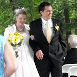
After a lovely wedding in Bethel and TWO zero days with my parents at Dolly Copp Campground, I hit the trail in Crawford Notch with Jerry (chemistry prof at UNE). We headed into the Presidentials with a wonderful weather forecast. Unfortunately on the second day we woke up to summits in the fog...with winds gusting up to around 60mph. That's enough to knock you sideways, and off your feet if you stumble. We had an ambitious 12 mile day planned, hitting all the mountain peaks along the ridgeline (Clinton, Eisenhower, Washington, Clay, Jefferson, Adams). We had lunch on Washington, and luckily as we descended the clouds started to lift. By the time we reached Jefferson we had clear views. The timing worked out well, as I had never hiked on the northern half of the Presies before, so that's where the views mattered most. Jerry got off at Pinkham Notch to head home, and I finished out the Whites through the Carter-Moriah Range.
Tuesday, July 6, 2010
In the Future
On to the higher summits of the Presidentials on Monday with Dr. Jerry Mullin (my hiking chemistry professor). Hope for good weather, as I'll be on an exposed alpine ridgeline (5,000 feet above sea level) for about 25 miles!! Once I enter Maine my folks will be meeting me at select road crossings to resupply me, starting at Grafton Notch, so I won't be stopping at many more post offices. If you really want to send me one last care packaged, mail it to Caratunk, ME 04925. I should be there by July 22. Posts may be few and far between from here on out, as I will be in the wild woods of Maine. Thanks for all your support!
Emily Writes Again
Great stay at a frat house in Hanover--cheers Dan. I appreciated the real bed. Easy couple days out of Hanover. New Hampshire did a nice job getting us ready for the whites...first a couple 1000 foot mountains, then a couple 2000 footers, a couple 3000 footers, and then MOOSILAUKE (a 4000 footer). Unfortunately I had no views from the top (the cloud ceiling was around 2000 feet that morning), but the summit was still amazing. The first real alpine zone of the trip. I'll definitely come back to day hike it in nice weather.
The first half of the White Mountains treated me fairly well. A few cloudy summits on the Kinsmans, but views late in the afternoon across to the impressive Franconia Ridge. The trail up the Kinsmans was RUGGED!! I had hiked North Kinsman last February, but the 3 or 4 feet of snow we hiked on made the trail seem smooth. I wasn't expecting the steep, wet rock ledges. Moosilauke and N. Kinsman both had rebar, wooden steps attached to rock faces, and lots of places you had to kind of jump and hope you landed on a flat, non-slippery surface. But it was a fun challenge. I love this kind of hiking. I spent a night at Liberty Spring campsite, just below the crest of Franconia Ridge. That afternoon I slack-packed up Mt. Liberty and Flume and got some awesome views. I'm glad I did, because the next day's "slight chance of rain, summits in the fog" actually meant that Franconia Ridge was cloudy, rainy, and winds gusting to 40mph. Nasty weather. I crossed the ridge without getting hypothermia, and ended up working to stay at Galehead Hut.
The Hut System
The AMC runs huts in the White Mountains, catering to weekend hikers with lots of money ($100 a night!!). Luckily, the college-aged hut croos have pity for thru-hikers who can't afford this price, and can't make reservations months in advance. If there is space, thru-hikers can work for about an hour (cleaning bunks, bathrooms, kitchen, etc.), then eat the leftover food from dinner and breakfast, and sleep on the floor in the dining room. It's kind of a strange system, makes the thru-hikers feel inferior to the paying guests, but I was glad for the option Thursday night. The weather cleared over night, and I had perfect weather (it felt like fall—40 degrees with a windchill) for the hike down to Crawford Notch, where my parents picked me up for a weekend off trail (to attend a wedding in Maine).
Sobos
I've finally met my first southbound hikers who started in Maine. Most have started around May 30 (taking a month to cross Maine and get into New Hampshire). Hit and Miss cruised past Rob and me when we were in Vermont, but I stopped to chat with Whoopie Pie (a girl from Ellsworth, ME), Hickory, Easy, and Bird. Bird spent the night at Galehead with me and another Nobo named Alpine (different from the guy who works at Neels Gap).
The first half of the White Mountains treated me fairly well. A few cloudy summits on the Kinsmans, but views late in the afternoon across to the impressive Franconia Ridge. The trail up the Kinsmans was RUGGED!! I had hiked North Kinsman last February, but the 3 or 4 feet of snow we hiked on made the trail seem smooth. I wasn't expecting the steep, wet rock ledges. Moosilauke and N. Kinsman both had rebar, wooden steps attached to rock faces, and lots of places you had to kind of jump and hope you landed on a flat, non-slippery surface. But it was a fun challenge. I love this kind of hiking. I spent a night at Liberty Spring campsite, just below the crest of Franconia Ridge. That afternoon I slack-packed up Mt. Liberty and Flume and got some awesome views. I'm glad I did, because the next day's "slight chance of rain, summits in the fog" actually meant that Franconia Ridge was cloudy, rainy, and winds gusting to 40mph. Nasty weather. I crossed the ridge without getting hypothermia, and ended up working to stay at Galehead Hut.
The Hut System
The AMC runs huts in the White Mountains, catering to weekend hikers with lots of money ($100 a night!!). Luckily, the college-aged hut croos have pity for thru-hikers who can't afford this price, and can't make reservations months in advance. If there is space, thru-hikers can work for about an hour (cleaning bunks, bathrooms, kitchen, etc.), then eat the leftover food from dinner and breakfast, and sleep on the floor in the dining room. It's kind of a strange system, makes the thru-hikers feel inferior to the paying guests, but I was glad for the option Thursday night. The weather cleared over night, and I had perfect weather (it felt like fall—40 degrees with a windchill) for the hike down to Crawford Notch, where my parents picked me up for a weekend off trail (to attend a wedding in Maine).
Sobos
I've finally met my first southbound hikers who started in Maine. Most have started around May 30 (taking a month to cross Maine and get into New Hampshire). Hit and Miss cruised past Rob and me when we were in Vermont, but I stopped to chat with Whoopie Pie (a girl from Ellsworth, ME), Hickory, Easy, and Bird. Bird spent the night at Galehead with me and another Nobo named Alpine (different from the guy who works at Neels Gap).
AT HIKER GLOSSARY
For those of you interested in such things...
Thru-hiker = one who hikes from Georgia to Maine (or the reverse) in one year
Section hiker = one who hikes large sections of the trail over several years
Day hiker = one who hikes on the AT on day trips (often the best bet for getting trail magic)
NOBO = a northbound hiker
SOBO = a southbound hiker
Flip-flop = thru-hiking the trail in sections, not in geographical order
GAME = Georgia to Maine
MEGA = Maine to Georgia
Zero = a day of zero mileage, for rest, relaxation, and resupply
Nero = a short day of hiking (nearly zero miles), with R&R
Yogi-ing = the act of looking starving to trick picnic-ers into giving you some food
Trail magic = unexpected acts of kindness encountered along the trail, such as a cooler of cold sodas, snack food at a trail junction, a ride into town, a free place to spend the night, etc.
Trail angel (or trail magician) = one who provides trail magic
Shelter or Lean-to = generally a 3-sided building with a sleeping platform, free for all hikers to spend a night in
Campsite = flat area, pad or wooden platform for tenting
Huts = fully enclosed, full service AMC resorts, $100 a night, or work for a free floor space
Bridge = foot bridge or road bridge over large rivers
Bog bridge = wood plank or split log bridging small trickles or mud holes
Ford = river crossing with no bridge or convenient stepping rocks, boot removal is necessary
Trail town = towns which the AT passes thru or near, providing key hiker services such as shuttles, laundry, grocery, internet, hostel
Shuttle = cheap or free rides to and from town
Hostel = cheap bunk room
Maintainer = volunteer who keeps the trail corridor free of obstacles (branches, blowdowns, etc.)
Ridgerunner = person paid to patrol a high-use section of trail and to offer advice and assistance as needed
Caretaker = person paid to live at a shelter/campsite for the summer, to maintain and care for the site
Privy = aka outhouse, may be a simple hole in the ground or solar composting
Thru-hiker = one who hikes from Georgia to Maine (or the reverse) in one year
Section hiker = one who hikes large sections of the trail over several years
Day hiker = one who hikes on the AT on day trips (often the best bet for getting trail magic)
NOBO = a northbound hiker
SOBO = a southbound hiker
Flip-flop = thru-hiking the trail in sections, not in geographical order
GAME = Georgia to Maine
MEGA = Maine to Georgia
Zero = a day of zero mileage, for rest, relaxation, and resupply
Nero = a short day of hiking (nearly zero miles), with R&R
Yogi-ing = the act of looking starving to trick picnic-ers into giving you some food
Trail magic = unexpected acts of kindness encountered along the trail, such as a cooler of cold sodas, snack food at a trail junction, a ride into town, a free place to spend the night, etc.
Trail angel (or trail magician) = one who provides trail magic
Shelter or Lean-to = generally a 3-sided building with a sleeping platform, free for all hikers to spend a night in
Campsite = flat area, pad or wooden platform for tenting
Huts = fully enclosed, full service AMC resorts, $100 a night, or work for a free floor space
Bridge = foot bridge or road bridge over large rivers
Bog bridge = wood plank or split log bridging small trickles or mud holes
Ford = river crossing with no bridge or convenient stepping rocks, boot removal is necessary
Trail town = towns which the AT passes thru or near, providing key hiker services such as shuttles, laundry, grocery, internet, hostel
Shuttle = cheap or free rides to and from town
Hostel = cheap bunk room
Maintainer = volunteer who keeps the trail corridor free of obstacles (branches, blowdowns, etc.)
Ridgerunner = person paid to patrol a high-use section of trail and to offer advice and assistance as needed
Caretaker = person paid to live at a shelter/campsite for the summer, to maintain and care for the site
Privy = aka outhouse, may be a simple hole in the ground or solar composting
Saturday, June 26, 2010
New Hampshire!!! (state #13)
Finally out of the mud hole that was Vermont. There were actually some really nice peaks (Glastenbury, Stratton, Bromley, Killington), but a lot of muddy tread way in between. Rob and I got a lot of trail magic in Vermont, starting of course with Uncle Don. The next day New York Minute ('08 thru-hiker) and Val had a grill set up at a road crossing, with hot dogs, hamburgers, fruit, and cold soda. On the 23rd we met Leo and Ana from Boston--they were really excited to meet a thru-hiker, and gave me a little bottle of Irish Whiskey. I redeemed my "Get out of trail jail free" coupon that Rob gave me for Christmas by getting a shower, laundry, and a bed a their house in Richmond for the night on Thursday. Very nice after getting drenched in a downpour earlier that day. Rob ended his trip 10 miles short of NH, to match Rosemary's schedule for picking him up.
June 24
Rob dropped me off in West Hartford, VT and I walked into New Hampshire. The last stretch was really easy, through a pine forest. I found a cooler of watermelon and sweet bread by the road in Norwich, VT. It was very much appreciated because it was a long hot road walk into Hanover, where I was met by Dan Mott. We spent the afternoon eating Ben and Jerry's and playing cribbage. Rachael joined us in the evening for dinner and Toy Story 3 (in 3D). It was very funny. I enjoyed it.
While in Vermont we met Kite and Sandpiper, Beans, Wazi, Tommy (PA to ME), Freedumb and Redtail (PA to ME), Cookie Monster, Olaf, Cool Tool, Yukon and Litterbox, Turtleback, The Roaming Gnomes (POW and TLC, finishing their thru hike from 08 and 09), Roaring Lion, Cakon, and Camp Chair. Most of them are now ahead of me.
I'm looking forward to Moosilauke and the White Mountains!!! Updates may be few and far between for the rest of my hike, as I don't have many town stays planned, but I will do my best.
June 24
Rob dropped me off in West Hartford, VT and I walked into New Hampshire. The last stretch was really easy, through a pine forest. I found a cooler of watermelon and sweet bread by the road in Norwich, VT. It was very much appreciated because it was a long hot road walk into Hanover, where I was met by Dan Mott. We spent the afternoon eating Ben and Jerry's and playing cribbage. Rachael joined us in the evening for dinner and Toy Story 3 (in 3D). It was very funny. I enjoyed it.
While in Vermont we met Kite and Sandpiper, Beans, Wazi, Tommy (PA to ME), Freedumb and Redtail (PA to ME), Cookie Monster, Olaf, Cool Tool, Yukon and Litterbox, Turtleback, The Roaming Gnomes (POW and TLC, finishing their thru hike from 08 and 09), Roaring Lion, Cakon, and Camp Chair. Most of them are now ahead of me.
I'm looking forward to Moosilauke and the White Mountains!!! Updates may be few and far between for the rest of my hike, as I don't have many town stays planned, but I will do my best.
Wednesday, June 23, 2010
Radical Rob Joins the Hike
It's hard to believe June is almost over already. The New England states are going by much more quickly than the Southern states. We have a very brief update for now, hopefully more later.
On June 8 Emily made it into Massachusetts. She hiked 20 mile days to meet up with Rob in North Adams. The mountains were getting bigger, which was exciting.
On June 12, Rachael met her in North Adams, MA for breakfast, before Rob and Emily hit the trail to Vermont.
On June 13, she met up with Radical Rob (his trail name) and they began hiking Vermont on the combination AT/Long Trail.
On June 19, Trail Angel Uncle Don showed up at VT. Rt. 104, with bags of fruits and vegetables and other trail magic. He had walked down the trail for a couple of miles hoping to meet them as they hiked northward, didn't see them but did meet Snow White and Rooster. Eventually Switchback and Radical Rob appeared and they had a good ol' lunch and filled their packs with provisions. Uncle Don Burchard was officially dubbed as a "Trail Angel" by Switchback.
On June 21, they got slowed down because Radical Rob re-injured a bad knee, so they are only doing about 7 miles a day. Weather has been hot & humid at the lower elevations but quite nice and comfortable up high.
Expected arrival dates in the future:
Glencliff, NH June 28
Crawford Notch July 3
Pinkham Notch July 8
Rt. 2 in New Hampshire July 10
Maine July 14
On June 8 Emily made it into Massachusetts. She hiked 20 mile days to meet up with Rob in North Adams. The mountains were getting bigger, which was exciting.
On June 12, Rachael met her in North Adams, MA for breakfast, before Rob and Emily hit the trail to Vermont.
On June 13, she met up with Radical Rob (his trail name) and they began hiking Vermont on the combination AT/Long Trail.
On June 19, Trail Angel Uncle Don showed up at VT. Rt. 104, with bags of fruits and vegetables and other trail magic. He had walked down the trail for a couple of miles hoping to meet them as they hiked northward, didn't see them but did meet Snow White and Rooster. Eventually Switchback and Radical Rob appeared and they had a good ol' lunch and filled their packs with provisions. Uncle Don Burchard was officially dubbed as a "Trail Angel" by Switchback.
On June 21, they got slowed down because Radical Rob re-injured a bad knee, so they are only doing about 7 miles a day. Weather has been hot & humid at the lower elevations but quite nice and comfortable up high.
Expected arrival dates in the future:
Glencliff, NH June 28
Crawford Notch July 3
Pinkham Notch July 8
Rt. 2 in New Hampshire July 10
Maine July 14
Monday, June 7, 2010
Emily Meets a Celebrity
June 1-6
It's been hot and humid, making hiking a lot of work. A lot of swamp walks too, with mosquitoes of course. I hiked a marathon on June 1--26.7 miles...in some massive thunderstorms. It was a long day, but not too tough (I didn't want to do just a 12mile day). I crossed into New York on that day and climbed over the Lemon Squeezer. It was a narrow crack in the rocks, followed by a 7 foot rock wall. Challenging because it was so wet.
June 2 I climbed Bear Mtn...it was pretty crowded. On the way down I got interviewed by a local newspaper reporter about the new trail on Bear Mtn. Grand opening on June 5...so I was a couple days too early. The trail-side zoo was small but neat. The lowest point on the AT is right in front of the bear pen. New York is a deli walk--you can stop at a store almost every day for food. I actually started skipping some because I wasn't really craving anything store-bought.
June 3 the Cambridge Boys (Walleye, No Point, Nap Time) and I were at RPH shelter eating supper, and David Miller (Awol) showed up to take photos of the shelter. Nap Time recognized him (he's the author to our guide books!), and he gave us some trail magic--apples, hohos, water. An AT celebrity. Too bad we didn't think to get his autograph. I heard that Nature Boy and Toeman have summited Katahdin already!!!
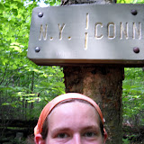
June 5 NEW ENGLAND!!! Crossed into Connecticut, and passed the largest oak on the AT.
June 6, Lauren (a college roommate) came to pick me up and I'm spending the night at her place for a nice relaxing evening.
Editor's Note: New England already!? Time for another round of superlatives! Get your submissions in now, via comment or email.
Also, two new verses have been added to Emily's song... go back and check it out
It's been hot and humid, making hiking a lot of work. A lot of swamp walks too, with mosquitoes of course. I hiked a marathon on June 1--26.7 miles...in some massive thunderstorms. It was a long day, but not too tough (I didn't want to do just a 12mile day). I crossed into New York on that day and climbed over the Lemon Squeezer. It was a narrow crack in the rocks, followed by a 7 foot rock wall. Challenging because it was so wet.
June 2 I climbed Bear Mtn...it was pretty crowded. On the way down I got interviewed by a local newspaper reporter about the new trail on Bear Mtn. Grand opening on June 5...so I was a couple days too early. The trail-side zoo was small but neat. The lowest point on the AT is right in front of the bear pen. New York is a deli walk--you can stop at a store almost every day for food. I actually started skipping some because I wasn't really craving anything store-bought.
June 3 the Cambridge Boys (Walleye, No Point, Nap Time) and I were at RPH shelter eating supper, and David Miller (Awol) showed up to take photos of the shelter. Nap Time recognized him (he's the author to our guide books!), and he gave us some trail magic--apples, hohos, water. An AT celebrity. Too bad we didn't think to get his autograph. I heard that Nature Boy and Toeman have summited Katahdin already!!!
June 5 NEW ENGLAND!!! Crossed into Connecticut, and passed the largest oak on the AT.
June 6, Lauren (a college roommate) came to pick me up and I'm spending the night at her place for a nice relaxing evening.
Editor's Note: New England already!? Time for another round of superlatives! Get your submissions in now, via comment or email.
Also, two new verses have been added to Emily's song... go back and check it out
Monday, May 31, 2010
New Posts
We've got a lot of new updates for you! The central portion of the trail is going well, albeit not very challenging.
Emily requests that no one plan to send care packages to Kent, which she will be arriving at on June 7th. She has put a forward on any packages from the past few mail sites and expects to receive them in Kent. After that, she will be stopping in Dalton MA June 11th. If you're sending mail, send it there. Remember, the post office will hold mail, so get your letters/packages in the mail with plenty of time to spare.
After Dalton, big brother Rob will be joining Emily on the trail for a while. Many adventures to ensue, I'm sure.
Emily requests that no one plan to send care packages to Kent, which she will be arriving at on June 7th. She has put a forward on any packages from the past few mail sites and expects to receive them in Kent. After that, she will be stopping in Dalton MA June 11th. If you're sending mail, send it there. Remember, the post office will hold mail, so get your letters/packages in the mail with plenty of time to spare.
After Dalton, big brother Rob will be joining Emily on the trail for a while. Many adventures to ensue, I'm sure.
Subscribe to:
Posts (Atom)